
I took two weekends in October for solo trips to Minnesota State Parks, first venturing to the far northern edge of the state and then going to the southwest corner. With apologies to a friend with a family tradition of state park trips in October, we’ll dub this my Parktober experience.
I’m a big fan of the fall—the changing colors, the crisp air, the lack of bugs. It’s a wonderous time to get outside and explore. I also like checking out parks I haven’t been to, trying to find something new and different. So this year I booked two separate trips to places I haven’t been before. In the process I probably tried to cram in more parks than I should have, but it’s hard to pass one up when you’re so close and might never get back there.
North: Big Bog
The first weekend in October I went north, staying at a cabin at the Big Bog State Recreation Area. I picked it mainly because it had a cabin available, which is a rarity.
When I set out the weather was overcast with intermittent rain, so not the greatest start. But the rain at least cleared up by the time I got to my first park.
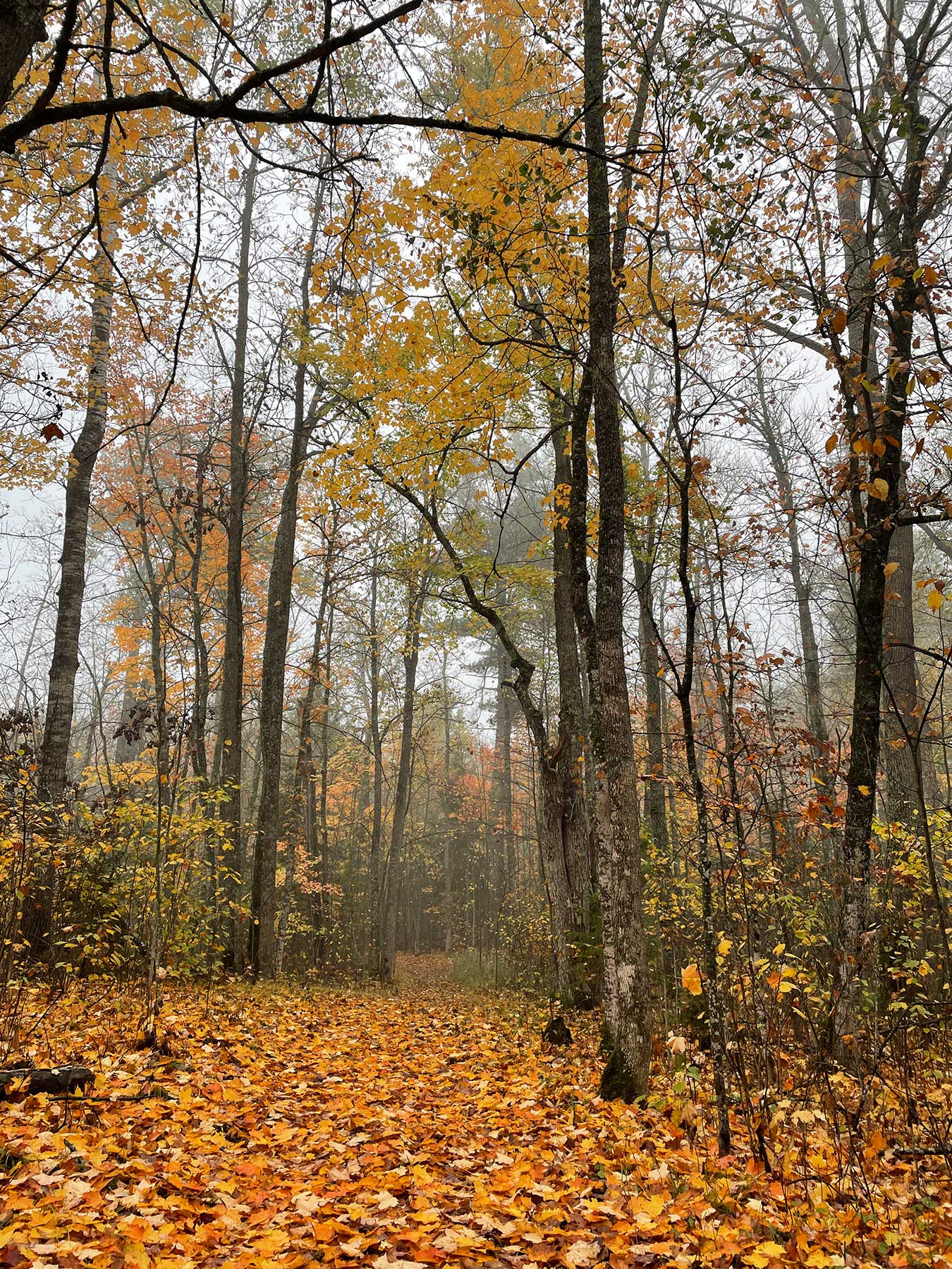
Savana Portage
Big Bog is pretty far north, so there were a lot of parks to hit on the way. Savana Portage was the first on my list. The leaves seemed to be nearly perfect here, only dampened by the cloudy skies.

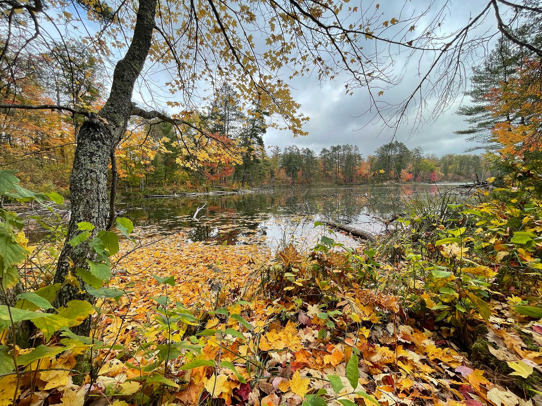

I did a short hike around Loon Lake and then had to keep moving. Definitely seemed like a park I need to revisit and further explore.
Schoolcraft
This park is basically a campground and picnic area on the Mississippi River, and the campground was closed. I didn’t have high hopes for this park, and it wasn’t that exciting. But it was a nicely forested stop with some unique views.

Big Bog
This park has two units, the southern unit sandwiched between Upper Red Lake and the Tamarac River. Unfortunately, you don’t see a lot of the Tamarac River. Upper Red Lake is the real draw. Red Lake is the largest inland lake in Minnesota, so we’re talking big. There were a couple short trails and a fire tower (closed), but the best was sunset over the lake and the stars over the lake.

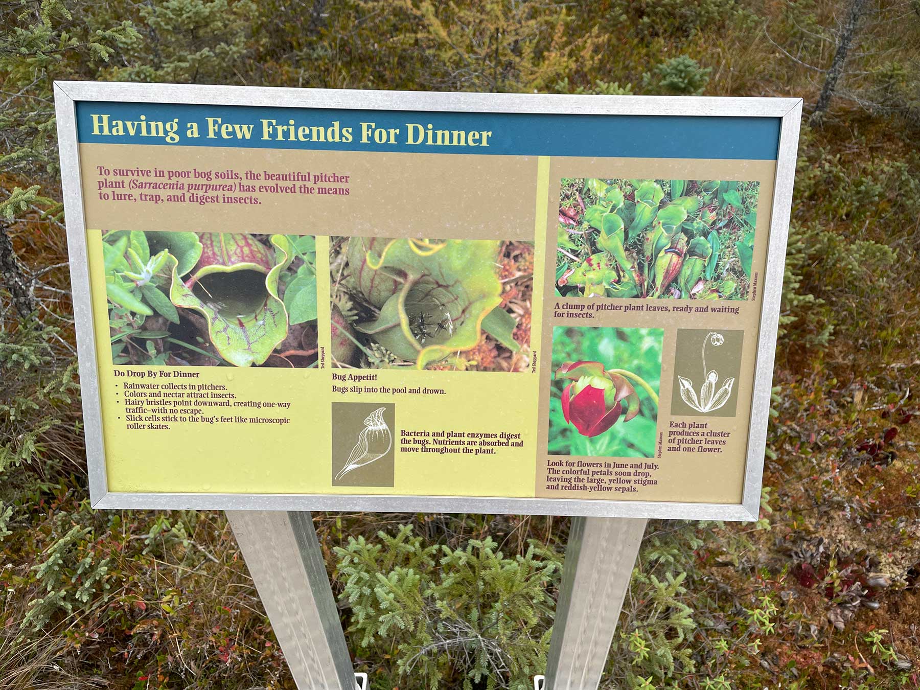
The northern unit is the real draw with the one-mile boardwalk trail over the bog. The bog is a uniquely weird ecosystem, with carnivorous plants, tamarack and spruce, and ground you could literally sink into (hence the boardwalk). The overcast day made it weirdly quiet and surreal.
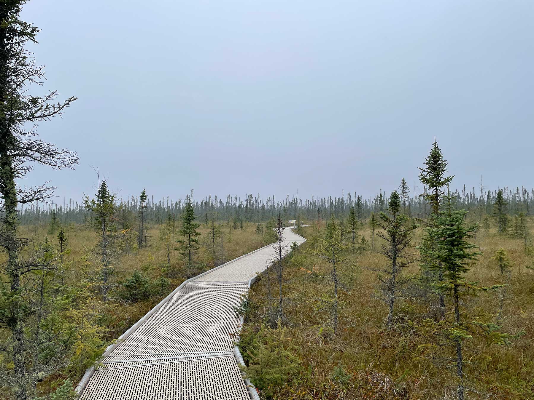


The leaves this far north were supposed to be past peak, but they seemed to be real hit and miss. Some hadn’t turned yet and some were gone. But there were brilliant flashes of color, especially while driving around.
Franz Jevne
This little park is perched on the Rainy River with Canada on the other side. It’s also mostly a campground and picnic area, with some trails, but the forested rockiness was worth the stop. My favorite part was the little island in the Rainy River that was fully accessible with the drought-lowered water.

Zippel Bay
Then I went a little farther north to Zippel Bay State Park on the shore of Lake of the Woods. This park definitely caters to boating and fishing, though the sandy shore reminded me of Lake Michigan or Lake Huron (seems like lakes in Minnesota rarely have sandy shores).
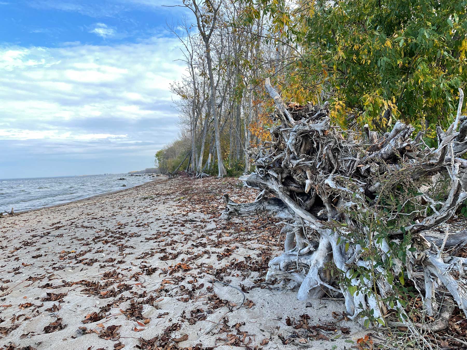

The best parts here were hammocking in the trees just off the beach and then driving through the golden leaves.


Scenic
On the way home I stopped at Scenic State Park for one more hit. Through the foggy morning drive I spotted my first deer of the trip. At Scenic, I did the Tell Lake Trail and the Chase Point Trail. Tell Lake had some decent leaves, though the esker on Chase Point Trail was the real highlight.
An esker is apparently where a river flowed through a glacier, leaving behind an elevated ridge between two depressions carved out by the glacier. So in this case, the trail goes along the top of the ridge with a lake on either side. It was weird and not at all what I expected—I was prepared for a sandy spit of land between two lakes, but it was actually really high, rocky, and forested, with glimpses of the two lakes through the trees. The swans seemed to be following my progress.

Scenic would be worth coming back for more.
South: Luverne
For my southern trip in mid-October, I got an Airbnb in Luverne, Minn., and hit a number of parks on the way there and back.
Ramsey Park
Know as the largest municipal park in Minnesota, Ramsey was the one non-state park I hit. It’s known for Ramsey Falls, which were definitely worth the stop.

I hiked around a bit on the concrete paths, which was a weird experience. Who paves their trails in concrete? It felt like an attempt at making the park more accessible (yay), except the concrete path often seemed to go out of its way to take steeper routes (boo).
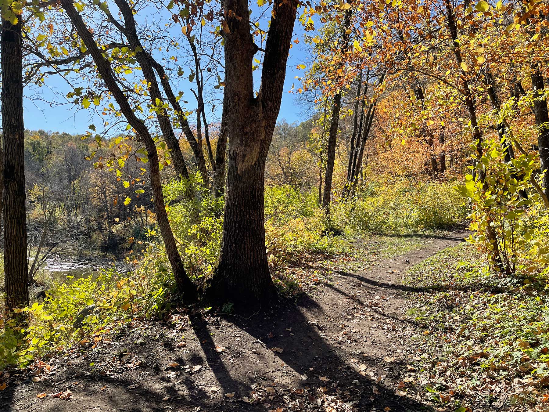
Camden
I brought my bike along for this trip, mainly so I could try the half mile mountain bike trail. It was short and hard to find, but definitely fun. It follows the top of a ridge, making it a bit precarious. Fallen leaves were also a bit of a challenge, but I was able to take the trail three or four times and didn’t die (the mark of a good mountain biking trip).
I also stowed my bike and took the River Trail hike. The leaves were probably past peek, but there was definitely a lot of orange so it was still pretty great. There was a lot to explore at this park and I felt like I scratched the surface.

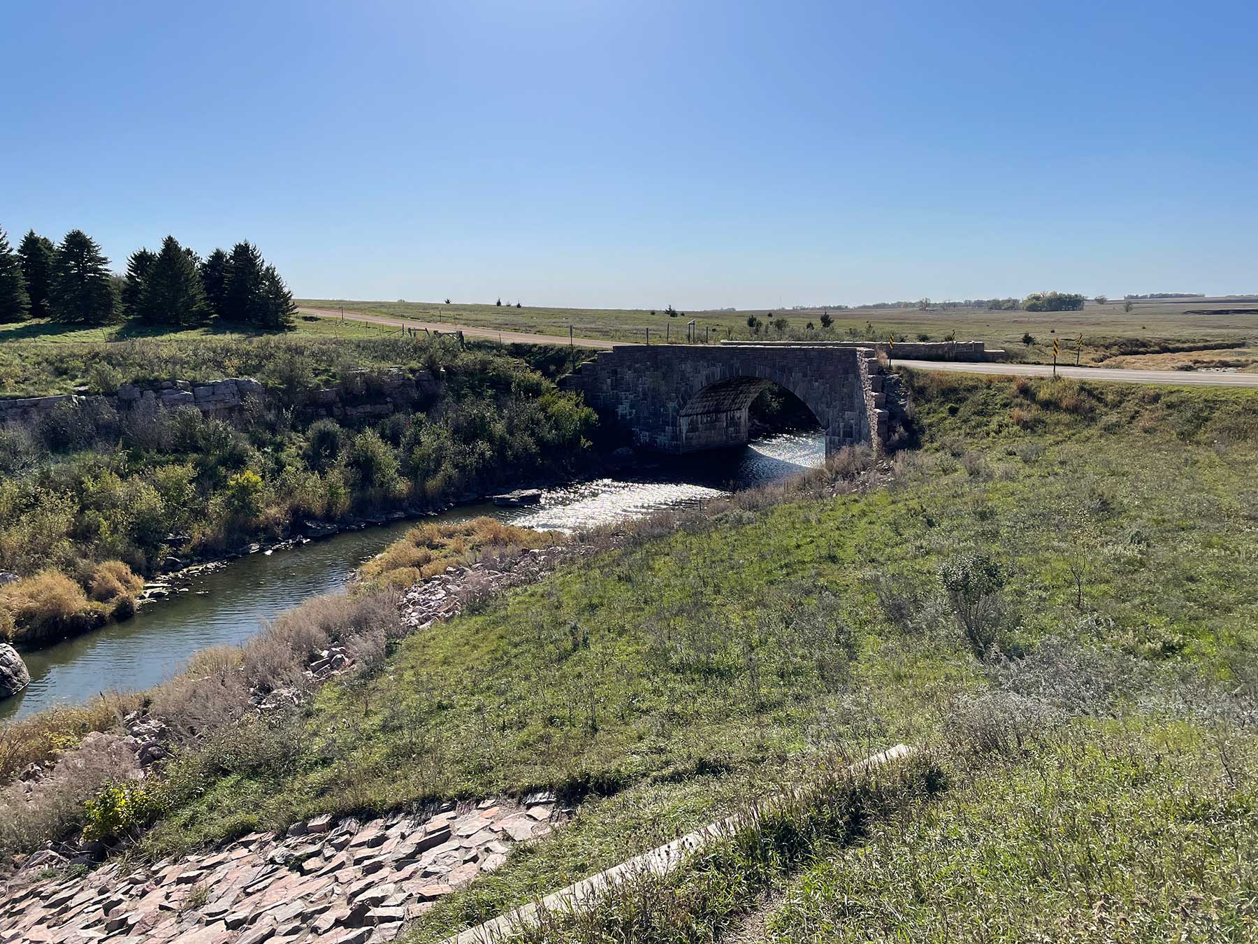
Split Rock Creek
Next was Split Rock Creek (not to be confused with Split Rock Lighthouse in the opposite corner of the state). This is another lake and campground park, with not a lot to do. I did a short hike around the dam, which was neat to see, but it’s not a park I’d need to revisit.
Blue Mounds
Blue Mounds feels more like prairie proper, which is fitting since they have a herd of bison. The park reminded me a lot of nearby Pipestone National Monument (which I hit a few years ago with the kids so I skipped this time around), with rock formations peeking out of the prairie. I did a little fo the prairie hiking, but not far enough to see any bison.
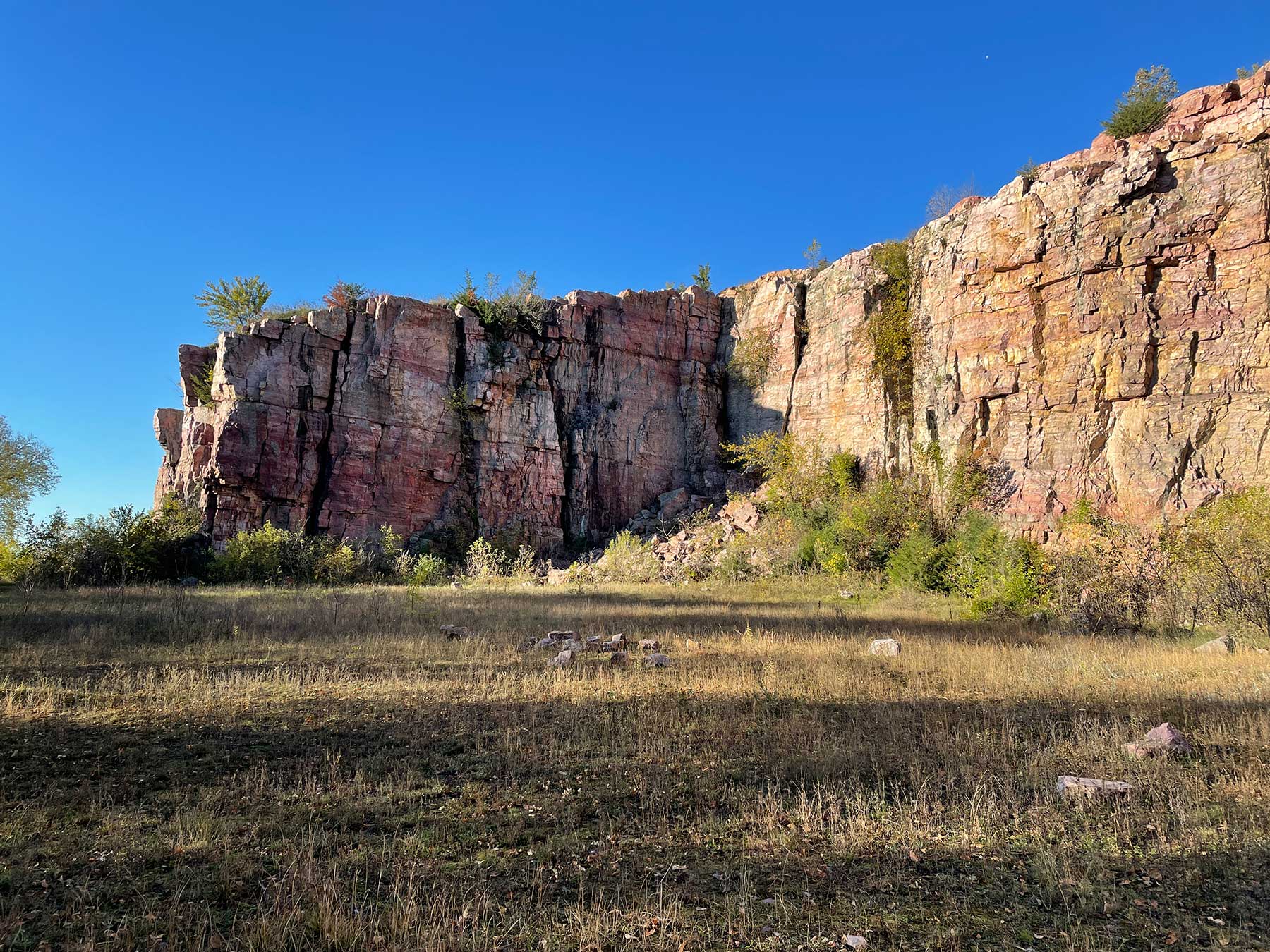
The real treat was hiking around the cliffs and quarry. The map makes it look like there’s not much hiking with a view of the cliffs, but ignore that. After the quarry, you can keep hiking north along the base of the cliff. You’re basically going through a small forested area that hugs the cliffs. Eventually there’s a path up the cliff that gets you to the Upper Cliff Trail, though it’s kind of hard to find. Hiking back along the upper trail actually had some great views as well. I spent a lot longer here than I thought I would.

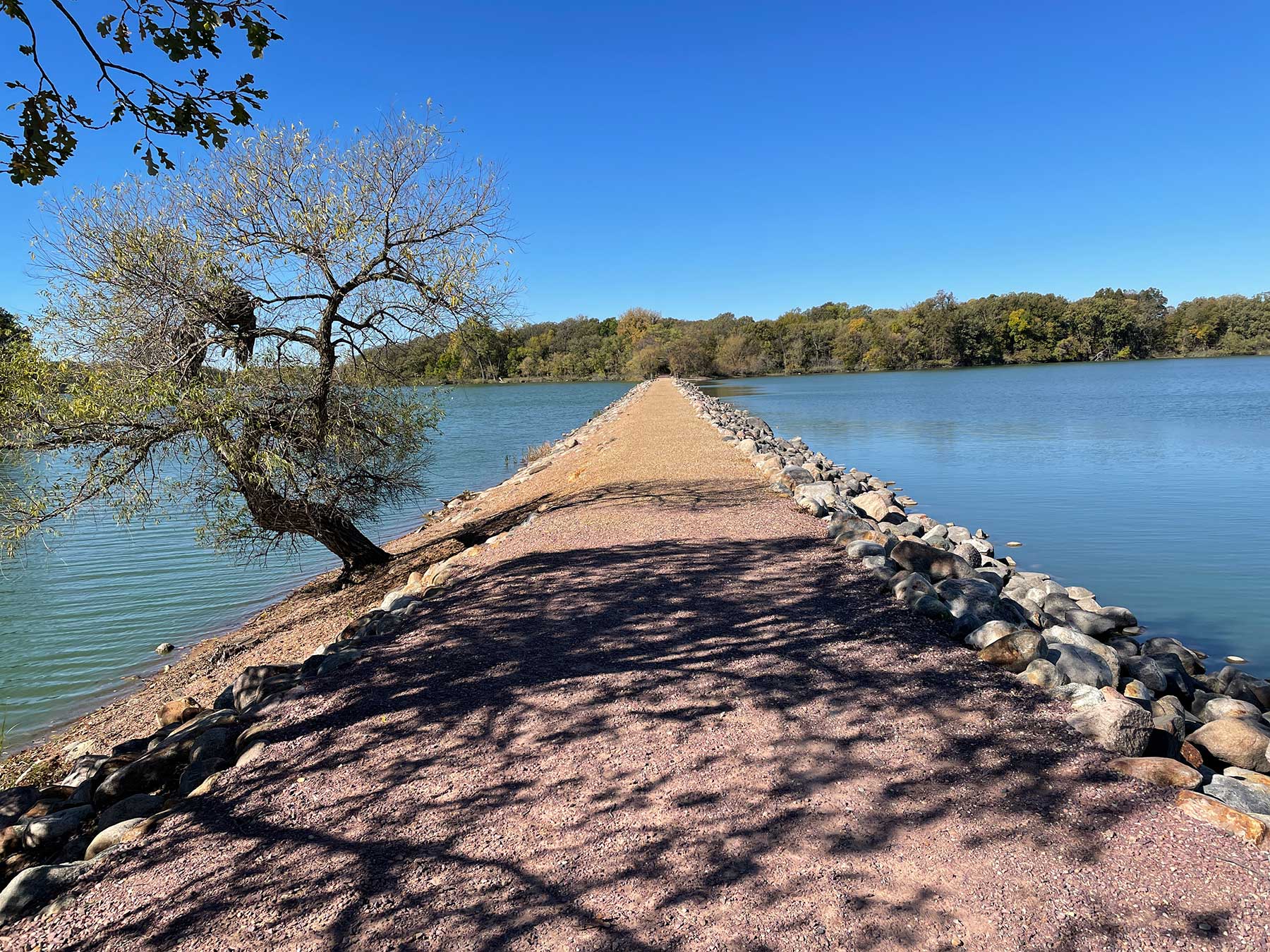
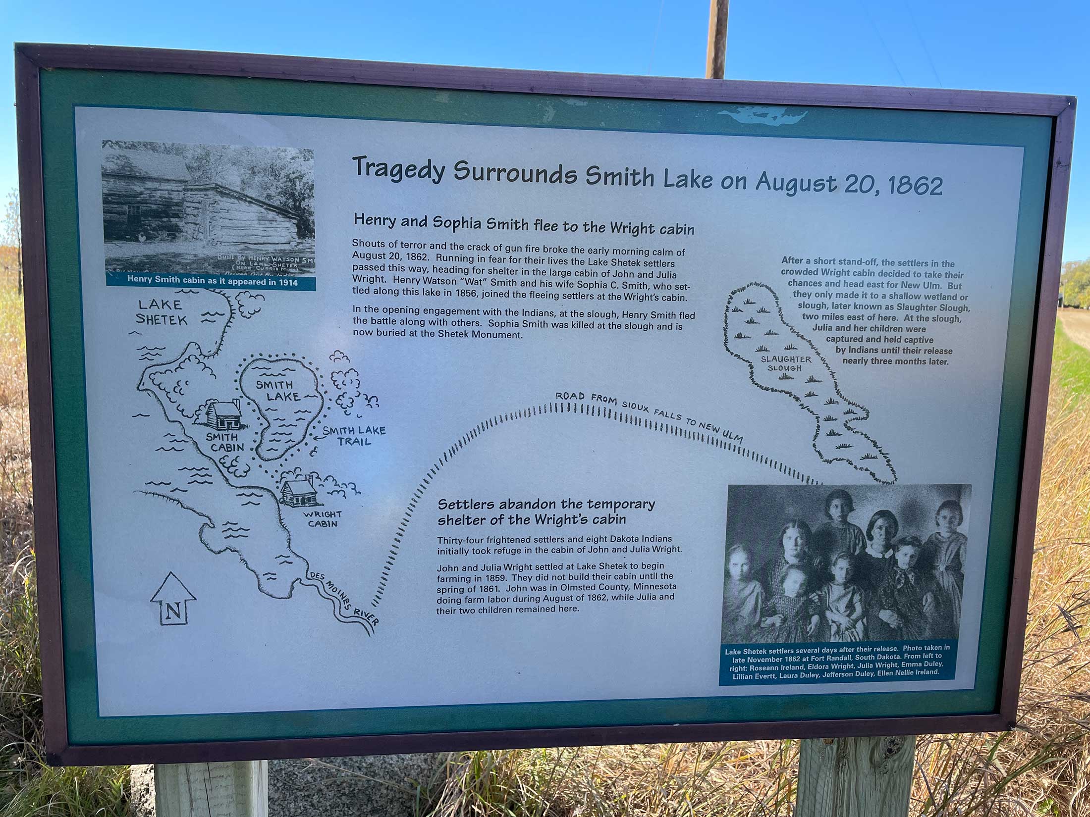
Lake Shetek
On the way home I stopped at Lake Shetek for one last park. While Lake Shetek is huge, this was more of a traditional forested park with several smaller lakes. I did cross the causeway out to Loon Island, but didn’t do the full island loop.
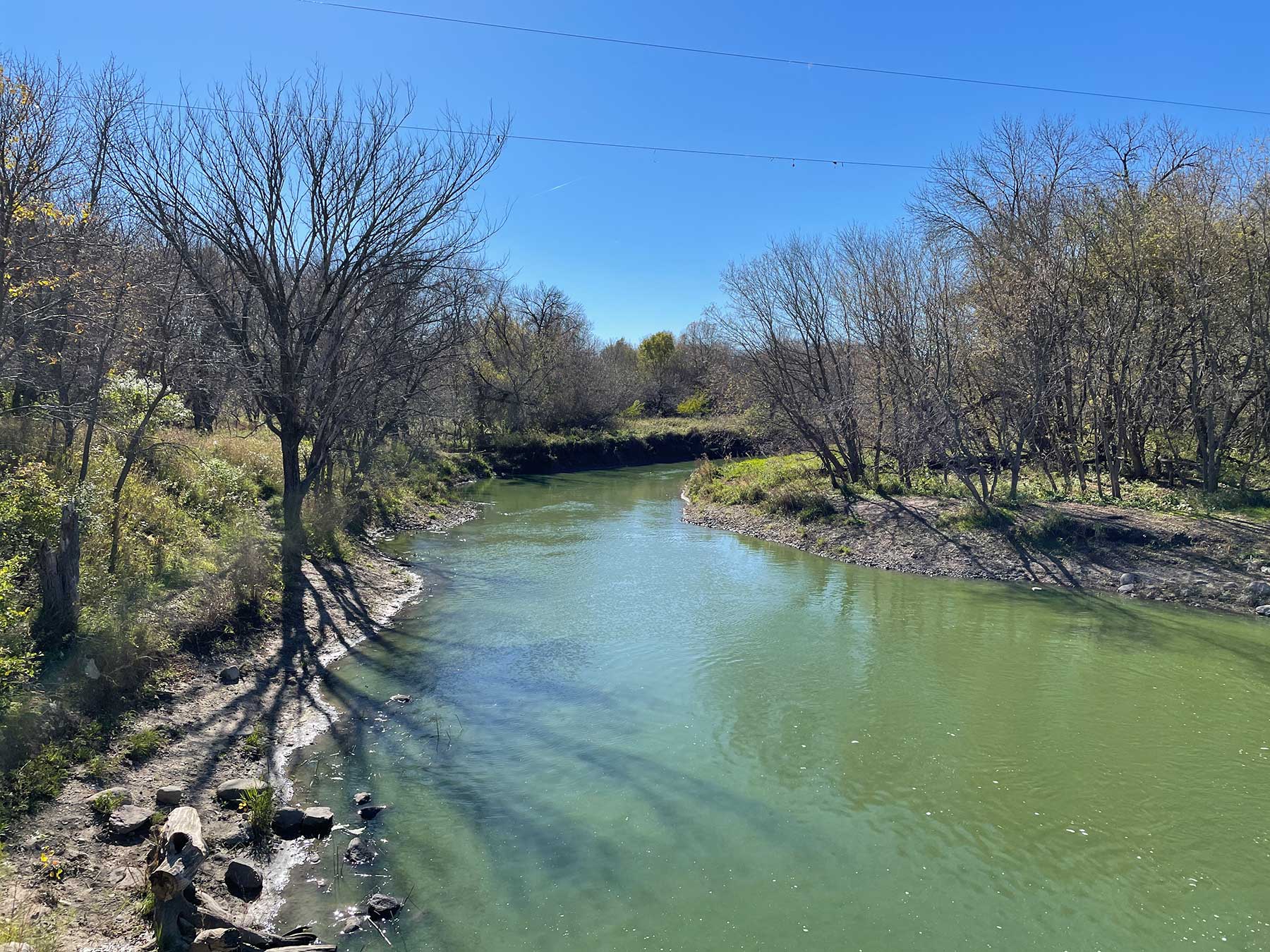
I did hop on my bike and took the Casey Jones State Trail past the Lake Shetek Monument and down to the Currie Dam on the Des Moines River.
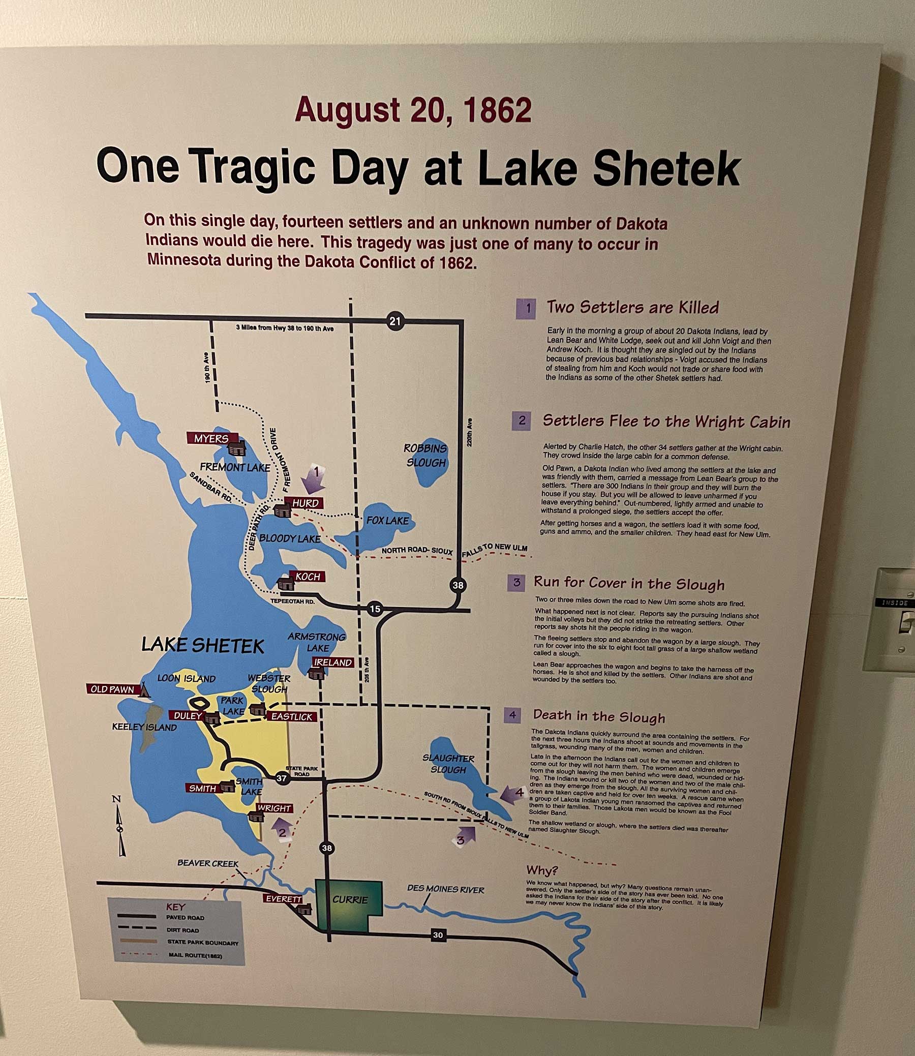
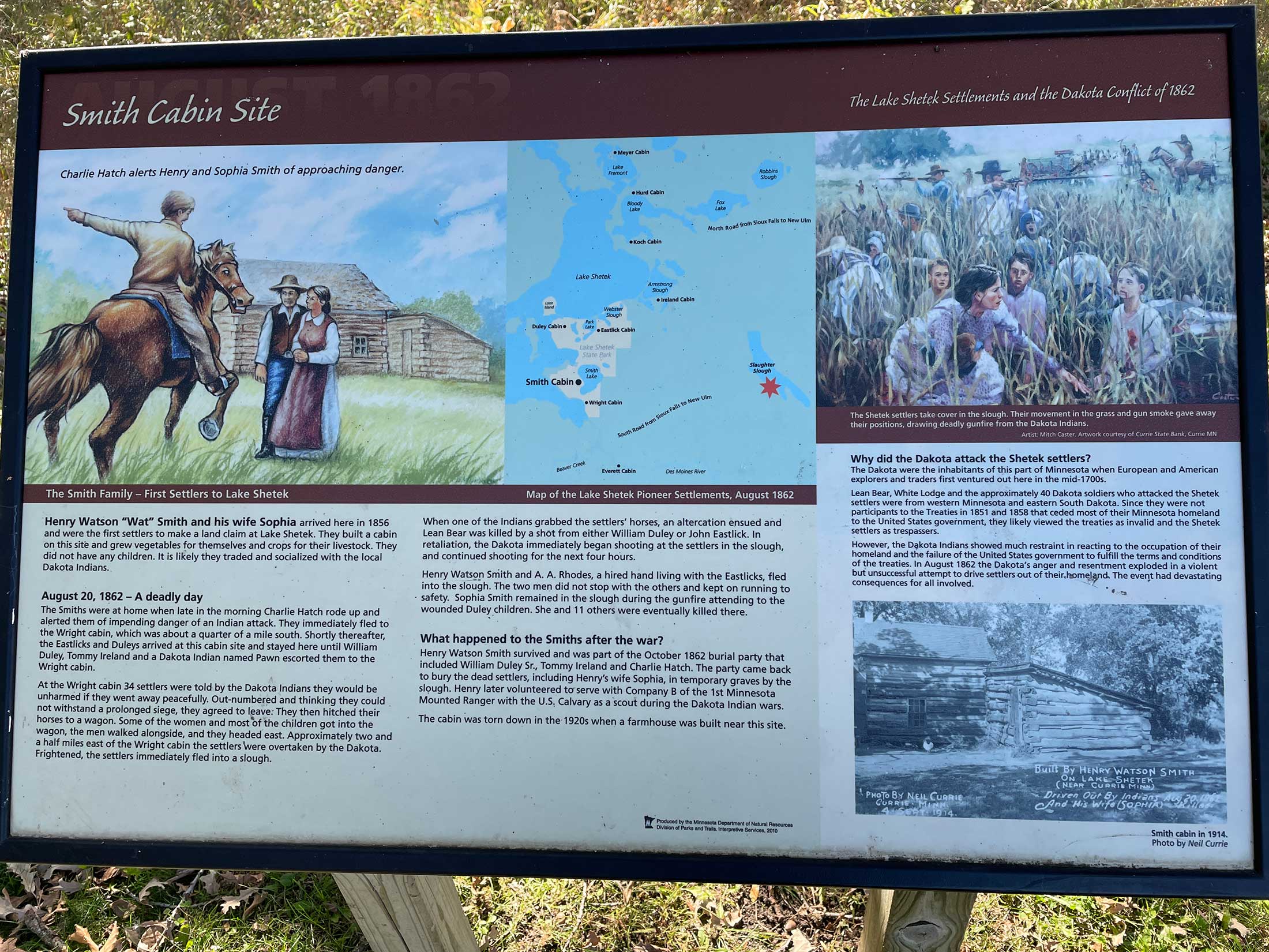
I didn’t realize the trail is basically a tour of the one of the sites of the Dakota War of 1862. Two settler cabins were located here that were attacked by the Dakota. A group of settlers negotiated a retreat, and while they were leaving the Dakota overtook them and some kind of argument broke out and the Dakota leader was shot and killed. Then it turned into a massacre as settlers escaped into a slough. Eventually a group of survivors escaped and a few were taken captive. The dead were later buried in a mass grave and a 25-foot pillar erected on the spot in 1925.

The weirdest part of this massacre tour is the lack of proper historical context. Most of the signage appeared to be created in 2010, but it went out of its way to avoid explaining the conflict. The sign at the monument literally didn’t say who killed the settlers. Some of the other signs were a little better, eventually including a more contextual explanation about the U.S. not living up to its treaty obligations and the Dakota rising up in response. Another display in the interpretive center talked about how the history of the massacre only included the settlers’ version of what happened and no one asked the Dakota for their side. While that’s true of much of the coverage at the time, the sign went on to talk about how we’ll never know what prompted the Dakota uprising. I’m far from an expert on this topic, but I’m pretty sure that’s not true. There’s plenty of documentation of the abuses of the Indian agents. Effectively, the Dakota gave up their land to settlers in exchange for goods and supplies. When they were cheated out of that food and starving, they did the only thing they could do and fought back, driving the settlers from their land.


It’s a complicated story for sure, one we haven’t been telling accurately for most of our history. But the fact that just over a decade ago we still couldn’t tell it right is pretty disheartening.
Parktober 2021
So there it is, 10 state parks and one local park for Parktober 2021.
I’m definitely a fan of booking a place to stay and hitting all the parks in the area, so I’ll have to do that again.
Kevin! I read every word of this post. So great! I want to do something like this, too. Hiking has been drawing me in so much lately. I even joined a Facebook group for women who hike in Minnesota. (Remember Facebook?) ANYway, thank you for your great reviews and writings, as always.